
Bring them home
Locate lost hikers, skiers and missing persons where dense canopy, snow or rock make a visual search nearly impossible.


Early access now open for qualified public safety agencies
Somewhere out there is someone who needs you. Flyhound turns the signal from their phone into a direction you can search — from the air, beyond the line of sight.
01 The technology
When the terrain is difficult and cameras aren't enough, Flyhound gives your team another way forward — a drone-mounted payload that detects, identifies, and localizes every cellular signal across the search area.
Mount the Flyhound payload on a supported platform and fly a standard orbit over the search area. No new airframe, no new certification path.
Look past what a camera can see. Flyhound picks up the radio emissions of each handset in range — the ones people are already carrying.
Each detection becomes a located, ranked search area on the map, so ground crews commit their hours where they count.
02 Missions
From a lost hiker on a ridge line to a community cut off by a flood — the mission changes, the need to find people does not.
Locate lost hikers, skiers and missing persons where dense canopy, snow or rock make a visual search nearly impossible.

Support evacuations and post-disaster sweeps with an aerial picture of where people still are, not just where they were.

Rapidly locate and identify suspects and make the arrest faster than ever before to help keep your community safe.
03 Built for the field
Your team already has a mission, a fleet and a way of working. Flyhound is designed to build on all three — with support for the public safety drone platforms you already fly and the workflows you already trust.
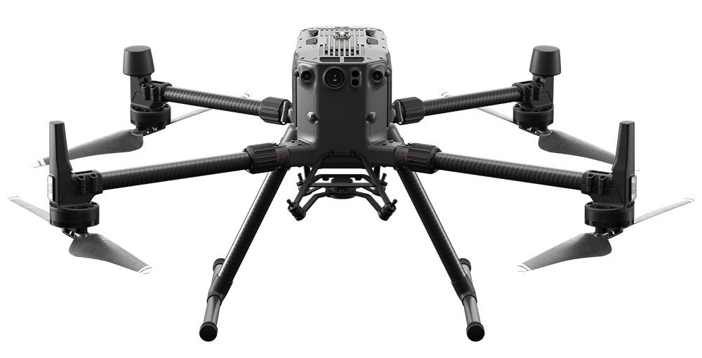
Flyhound attaches to the aircraft public safety teams are already flying. If yours isn't listed, ask us — the list keeps growing.
| Manufacturer | Model / series | Payload compatible |
|---|---|---|
| DJI | Matrice 210, 300, 350, 400, 600 | Yes |
| DJI | Matrice 30, 4 Series | Yes* |
| DJI | Inspire 2 | Yes |
| DJI | Phantom / Mavic / Mini | No |
| Skydio | X10/X2 | No |
| BRINC | Responder | No |
| modovolo | Lift | Yes |
| Parrot | ANAFI USA / AI | No |
| Teledyne | FLIR SIRAS | No |
| Autel | Evo II Dual 640T | Yes* |
| Autel | Evo Max 4T | Yes* |
| Autel | Dragonfish | Yes |
| Inspired Flight | IF1200A | Yes |
| Quantum Systems | Trinity Pro | Yes |
| Yuneec | Typhoon | Yes |
* Contact us to confirm the configuration for your airframe.
Refined alongside public safety pilots so deployment takes minutes, not a manual.
Encryption at rest and in transit, with clear boundaries around sensitive operational information.
Training, onboarding and support so your team gets value from the very first deployment.

A rescue that could take days and hundreds of man-hours can get down to minutes.

04 Our purpose
Technology is only as meaningful as the difference it makes. Flyhound exists for the responders who head out into the dark, and for the people waiting to be found.
We build in Syracuse, New York with our engineers and customer advisors in the room — because the field, not the lab, decides what actually works.
05 Questions
Can't find what you need? Talk to the team.
No cellular tower coverage is required. Flyhound detects the radio emissions from the handset itself, which is why it works in remote terrain where a phone shows no bars.
Flyhound attaches to most enterprise airframes with payload capacities that can support our size and weight. See the full compatibility table under Platform, or ask us about the aircraft you fly.
Data is encrypted in transit and at rest, and remains under your agency's control. We design around the privacy and chain-of-custody expectations public safety teams operate under.
If your pilots can fly a search grid, they can fly Flyhound. Onboarding is measured in hours, and we run it with your crew on your own equipment.
Start with a short conversation about your terrain, your fleet and your call volume. Apply using the link below.
Early access program
Bring a new capability to your agency. Let's talk about your team, your terrain and your next mission.